The use of unmanned aerial vehicles (UAVs), also known as drones, and connected analytics
has great potential to support and address some of the most pressing problems faced by
agriculture in terms of access to actionable real-time quality data.
It can be used at different stages throughout the cropping cycle:
- Soil and field analysis – After getting precise 3D maps for soil, planting can be planned and nutrient status can be analysed for further operations:
- Planting – UAS shoot seeds with nutrients in the soil with an average uptake of 75 percent, thus bringing down costs for planting.
- Crop monitoring – Time-series animations can show the precise development of a crop and reveal production inefficiencies, enabling better crop management.
- Irrigation – Drones with hyperspectral, multispectral, or thermal sensors can identify which parts of a field are dry or need improvements.
- Health assessment – By scanning a crop using both visible and near-infrared light, drone-carried devices can identify which plants reflect different amounts of green light and NIR light. This information can produce multispectral images that track changes in plants and indicate their health.
Multispectral images of fields, usually are used by farmers through the internet services like Sen2-Agri (http://www.esa-sen2agri.org/), Onesoil (https://onesoil.ai/en/), etc. These sites use pics from space (for example, from Sentinel satellites)


The main problem with satellite imagery is low temporal and spatial resolution. Free Sentinel satellites provide accuracy of the order of 10 meters per pixel, which is not enough to achieve accuracy. This is added by the fact that the data processing cycle around the Earth is 10 days, so the data time delay is on average 3-5 days, which in summer may not be fast enough for making decisions. Paid satellites give a resolution of up to 2 meters per pixel, but they are paid. And all satellites have a cloud problem, in some areas cloud cover can reach 50% of the time. At the same time, areas covered by clouds in space images are “fake” – they are “drawn over” by images from neighboring images, which reduces their reliability. As a result, the information received by farmers from satellite images gives the accuracy of determining the level of macroelements (nitrogen, phosphorus, potassium, humus) in the soil no more than 75%, and even with a noticeable delay and inaccuracy of location.
When shooting from UAV, a farmer can get a resolution of up to 3-5 cm, that is, more than 100 times better. Accordingly, the accuracy of determining the level of macronutrients can reach 90-95%. On the other hand, the number of fields in agricultural farms can be measured in tens of pieces, sufficiently spaced apart, one field occupies tens and hundreds of hectares or acres. As a result, in the midst of fieldwork, it is quite difficult for a farmer to independently fly around all the fields entirely on UAV, this can take several days. Flight Crew Fees – Average daily mapping rate from $ 800 to $ 1200.
The most promising for today is the combination of images from satellites and images from UAVs. Biologists believe that it is multilayer observation – the combination of ground observation data, satellite images, and photographs from a drone – that gives the best results in the work. With the use of machine learning technologies, AI, with the simultaneous processing of images from satellites and UAVs, it is possible to achieve high accuracy of 90-95% over the entire area without significant costs.
Another problem of using drones on your own. Usual quadcopters have a very short range – 50-100 hectares per flight and therefore are used in the fields. Fixed-wing UAV requires a farmer to acquire pilot qualifications, cannot automatically take off and land, are traumatic and provide images with low quality and resolution.
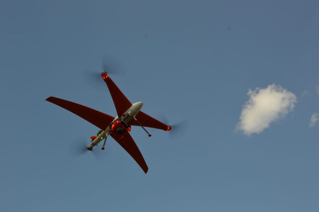
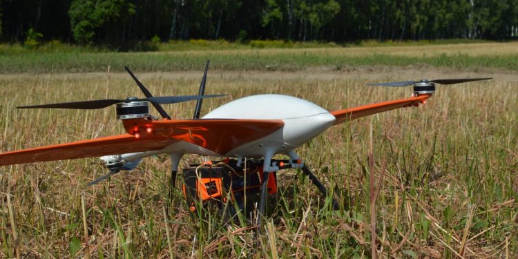
The solution is to use a new type of drone – the Optiplane rotorcraft. They combine the advantages of copters and fixed-wing but are devoid of their disadvantages. Unlike a copter, the rotorcraft can cover an area up to 10 times larger in one flight – more than 1000 hectares. Unlike a fixed-wing UAV, the rotorcraft does not require the farmer to be able to operate a UAV – the entire flight from takeoff to landing is fully automatic. After setting, he automatically sees recommendations for correcting fieldwork in his phone or on his tablet – NDVI, NDWI, AF1, ARI1 maps, special information.


