#PrecisionAgriculture #AerialCropSensing #RemoteSensingTechnology #CropHealthMonitoring #PrecisionFarming #EnvironmentalSustainability #AgriculturalInnovation
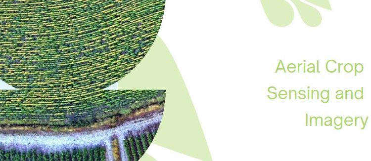
Aerial crop sensing and imagery have revolutionized the field of agriculture by enabling farmers to optimize their crop management practices like never before. This technology harnesses the power of remote sensing, utilizing crop reflectance data and vegetation indices to detect and address various crop issues. From assessing plant nutrition and health to identifying moisture stress and overall crop performance, these advanced imaging techniques provide crucial insights that may not be visible to the naked eye. In this article, we will explore the development of aerial crop sensing and imagery, its remarkable benefits, and its consequences on the future of agriculture.
Development:
- Remote Sensing and Crop Reflectance Data
Aerial crop sensing relies on remote sensing technologies mounted on drones, satellites, or aircraft. These sensors capture data by measuring the electromagnetic radiation reflected by the crops. Different crops reflect varying wavelengths of light depending on their health, chlorophyll content, and moisture levels. This data is then processed to create crop reflectance maps, indicating potential issues that may be affecting crop growth. - Vegetation Indices and Canopy Temperature
Vegetation indices are mathematical algorithms applied to crop reflectance data to extract specific information. These indices, such as the Normalized Difference Vegetation Index (NDVI) and Green Chlorophyll Index (GCI), help identify areas of nutrient deficiencies, stress, or diseases in the field. Additionally, canopy temperature information can indicate water stress or irrigation problems, enabling farmers to implement targeted interventions. - Identifying Invisible Crop Issues
One of the most significant advantages of aerial crop sensing is its ability to detect crop issues that are not apparent to the human eye. For instance, nutrient deficiencies or early-stage diseases may not manifest visible symptoms initially. By identifying these invisible problems early on, farmers can take proactive measures to mitigate potential yield losses and optimize resource usage. - Complementing Field Crop Assessments
While aerial imagery provides valuable insights, field crop assessments remain indispensable for comprehensive analysis. Agronomists and farmers work together to ground-truth the data collected from aerial sensors. The combination of aerial imagery and field assessments enhances the accuracy of problem diagnosis and allows for a more informed decision-making process.
Consequences of Development:
- Precision Agriculture and Resource Optimization
Aerial crop sensing has paved the way for precision agriculture, where farmers can tailor their actions based on specific field conditions. By identifying areas with specific issues, farmers can target their interventions, such as applying fertilizers only where needed or adjusting irrigation practices, leading to more efficient resource utilization. - Improved Crop Yield and Quality
With timely detection and intervention, aerial crop sensing contributes to improved crop yield and quality. By addressing issues promptly, farmers can prevent yield losses caused by pests, diseases, or nutrient imbalances, resulting in healthier and more abundant harvests. - Environmental Sustainability
Precision agriculture, enabled by aerial crop sensing, promotes environmental sustainability. By using resources more efficiently, farmers reduce the risk of over-fertilization, minimize water wastage, and decrease the use of pesticides, thus lowering the ecological impact of farming practices. - Enhanced Decision-Making and Planning
Access to detailed and real-time crop information empowers farmers to make informed decisions and plan their operations strategically. By understanding the specific needs of their crops, farmers can optimize planting schedules, implement appropriate pest management strategies, and improve overall farm management practices.
Aerial crop sensing and imagery have ushered in a new era of precision agriculture. By harnessing remote sensing technologies and advanced data analytics, farmers can proactively address crop issues, leading to improved yields, optimized resource usage, and sustainable farming practices. As this technology continues to evolve, the future of agriculture looks promising, offering better food security and environmental stewardship.
Source: Australian Potato Growers


